In May 2006, We flew to LA and drove a rented Chrysler PT Cruiser to the Grand Canyon.
The little car had a tough time on the hills in Arizona,
but that might have been because it was tuned for sea level
and not for the 7000-foot plateau.
|
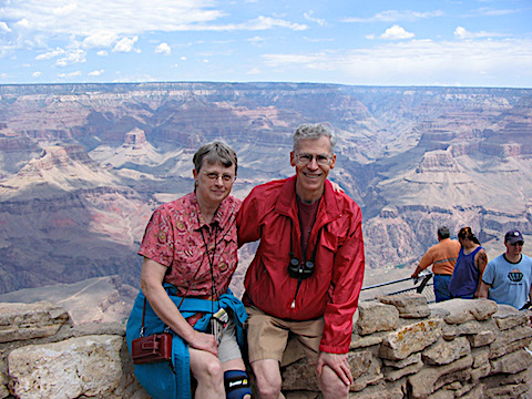
Here is a picture of Gail and Al at Mather Point,
where we first arrived at the south rim of the Grand Canyon.
You drive up from Williams, AZ, and this view is just steps away from the first parking area
inside the park. Awesome!
|
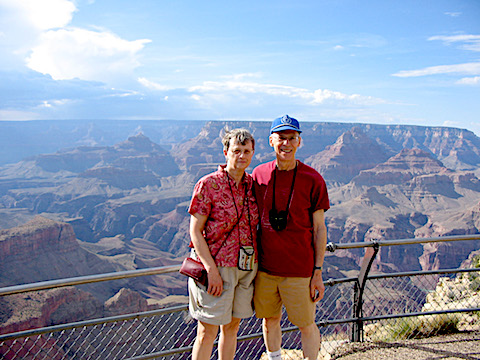
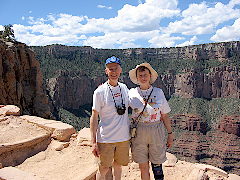
Here's another photo of us in front of the canyon. This is from a different location; I think it is Navaho Point. It was easy to ask people to take our photograph for us, and vice versa. People were there from all over the world... Italy, Germany, Israel, Japan, China, etc.
|
|
|
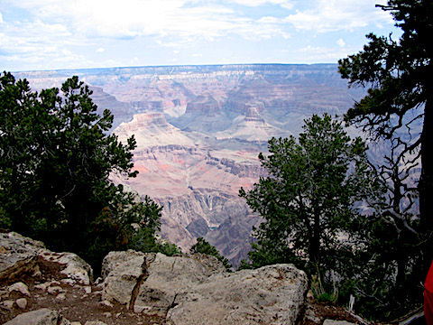
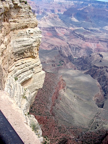
In this picture you can see all the way down to the river.
The Colorado River is the little dark green splotch about halfway
between the picture's center and its bottom.
The dark grey rock between the river and the reddish formation is about 1000 feet tall.
|
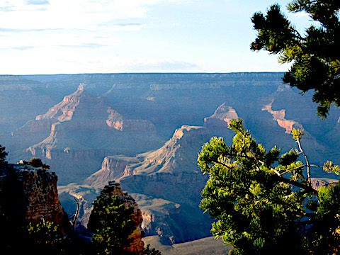
The changing light conditions kept giving the canyon different appearances.
This photo is from the late afternoon.
|
|
|
|
It’s a long way down!
|
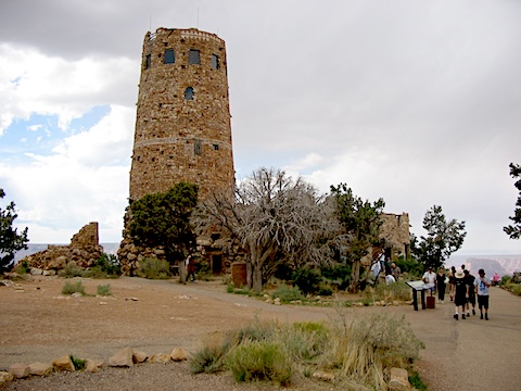
The Lookout Tower stands on the edge of the canyon at Desert View about 23 miles
up stream from the central park area. A woman working at the gift store inside
the tower told us that she volunteers half time and the park gives her a free camping site.
That gave us the idea to see the nation by volunteering at state parks in places
we had never been. We began doing this at a
park in Idaho in 2013.
and continued until grounded by Covid-19 in 2020.
|
|
Gail and I did hike a little way down into the canyon.
Here we are at Ooh! Aah! Point on the Kaibab Trail.
It is a full day's hike to get to the bottom and another day's hike to get back to the rim.
We were not sure our legs would hold out so we only took the 1.5 hour round trip to this point.
I thought maybe we could go on one of the mule trips into the canyon,
but my two-month advance planning was too short to get a reservation.
Mule trips start taking reservations 18 months in advance.
After leaving the Grand Canyon, we stopped at an overlook for the
Little Colorado River. The gorge was impressive, but no contest with the
Grand Canyon.
|
|
|
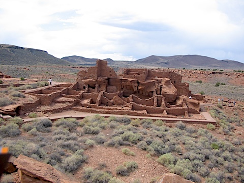
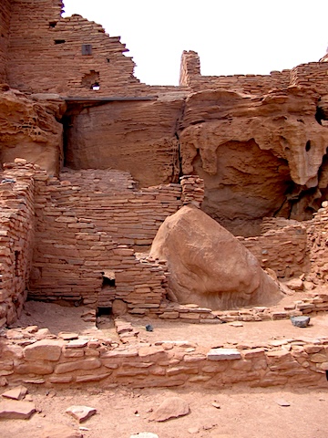
Next, we visited ruins of Native American pueblos at
Wupatki National Monument.
This is the Wupatki Pueblo. It is the largest dwelling in the monument and
could have housed 85 to 100 people.
|
A close up of pueblo construction.
|
|
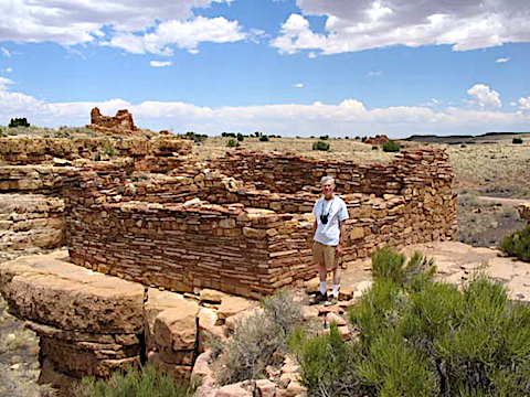
This one sits on the rim of small box canyon and dates from around 1200 AD.
Two neighboring pueblos are visible behind it.
|
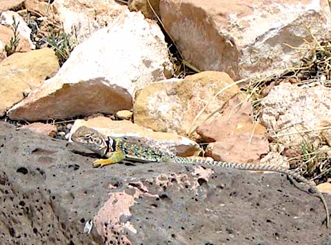
In Arizona, we saw a lot of interesting wildlife - California condors, a big horn sheep,
mule deer, western blue birds, ravens, violet-green swallows,
and this colorful little Collared Lizard at Wupatki.
|
|
|
When we drove back to California, the temperature was about 109 deg F (43 C) going into Needles.
We went to my college reunion in Pasadena on Friday evening, attended a series of seminars
for alumni on Saturday, and then attended an open house at the Jet Propulsion Lab on Sunday.
It was quite a change going from Saturday's seminars, where the median age might have been 70,
to the open house on Sunday, where the median age was more like 10.
At the end of our trip, we visited with Doug and his girl friend Lori at San Juan Capistrano.
The mission was established in 1776, and the church was ruined by an earthquake in 1812.
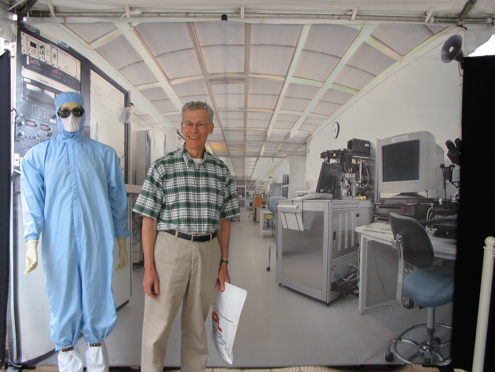
Al at JPL with a dummy dressed for work in the clean room,
both in front of a photo-mural of a clean room
|
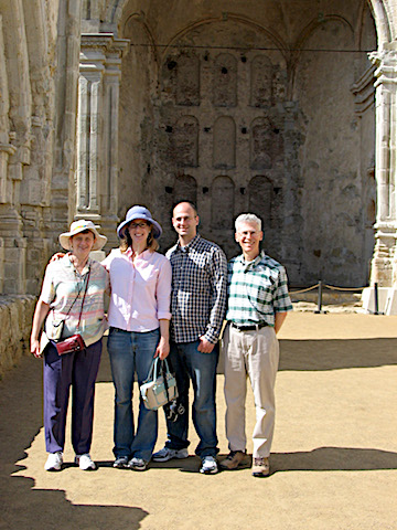
Gail, Lori, Douglas, and Albert at the historic stone church
of the mission of San Juan Capistrano
|
|
|
|
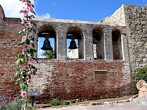
Mission bells at San Juan Capistrano
|
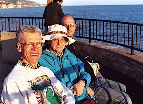
Al, Gail, and Douglas at Laguna Beach
|
|
|
Back home again, I took the rest of the week off,
doing things like putting this trip report together,
while Gail is back to work preparing for the next session, which starts on Tuesday.
Responsible: Albert Holm
Created: 5/26/2006; Updated: 5/29/2026