|
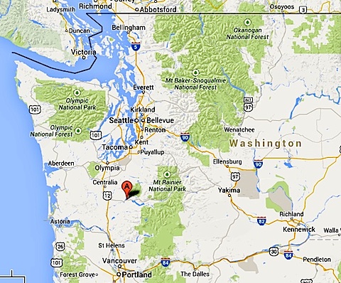
In the summer of 2014 we've been to Paradise and Hell, that is, the Paradise Visitor Center
on Mt. Rainier and the Hells Canyon of the Snake River.
For our summer adventure, we decided to go all the way to the West Coast.
We picked Washington state,
and applied to be volunteers in
the state park system. We were chosen to be campground hosts at
Ike Kinswa State Park in June, and at nearby
Lewis and Clark State Park
in July. The map at the right shows approximately where we were located,
a little west of Mt. Rainier and Mt. St. Helens.
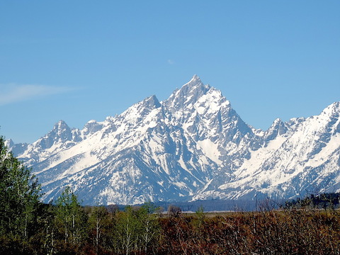
On our way west we stopped at Grand Teton National Park,
crossing the 9,584-foot-high Togwotee Pass to get there.
While in Washington, we also visited Mount Rainier National Park,
Mount St. Helens National Monument,
and Olympic National Park.
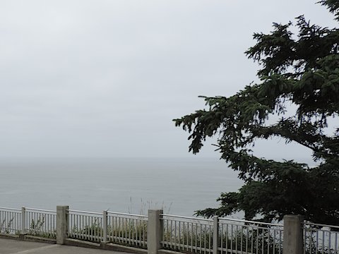
We got to see
the Pacific Ocean at Cape Disappointment and
Westport. We also hiked in
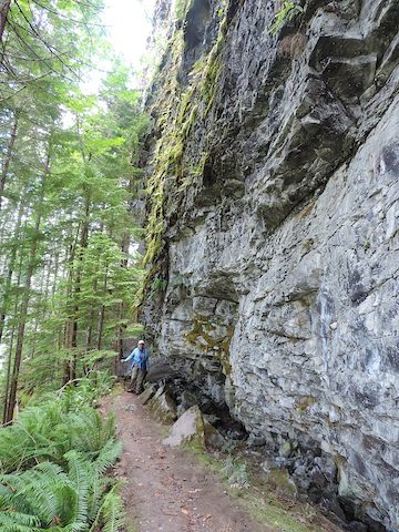
Pinchot National Forest.
Heading back toward Maryland, we took a 59-mile adventure cruise
up the Snake River into Hells Canyon.
Next we stopped at Bruneau Dunes State Park in Idaho, where we had volunteered
in 2013.
After that we headed for Kenora, Ontario, for
a reunion of Al's cousins, but on the way Al had an
accident in North Dakota that
damaged our Moving House.
Fortunately we were still able to proceed.
After Kenora, our last destination before heading home was
Iron River, Michigan.
|
|
|
Grand Teton Mountain seen from the Willow Flats Overlook
|
|
|
Grand Teton National Park
has a great WOW factor, especially with snow coating the mountains.
We had never visited this park before and were not sure what to expect.
We enjoyed all of our four full days there.
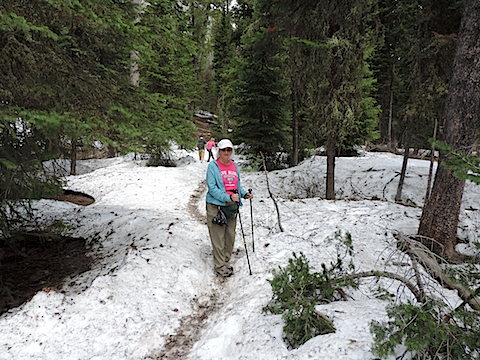
We had joked before coming
that we might have to wade through waist-deep snow and now found it was true,
at least for some trails.
When we asked a ranger at the Colter Bay Visitor Center about day hikes, he
informed us that many of trails were under snow and inaccessible.
But there were plenty of trails that were mostly clear, with
snow only in shaded areas and even that usually had a hard crust from where
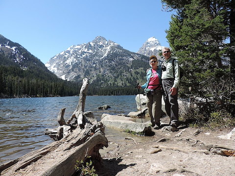
other hikers had walked. During our four days in the park, we walked
around the Lakeshore Trail on a peninsula sticking out into Jackson Lake,
and on trails to
Swan Lake and Heron Pond, to Christian Pond
and Emma Matilda Lake, part
way around Jenny Lake and to Hidden Falls,
to Phelps Lake and to Taggart Lake.
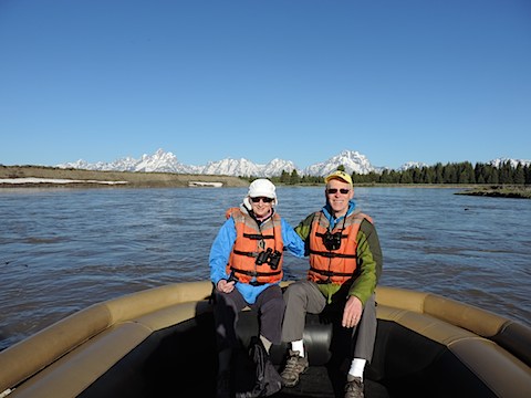
We also took a two-hour scenic raft trip down the Snake River. We were the
only customers on the 6:45 A.M. trip.
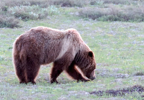
We saw plenty of wildlife, including our first grizzlies (Momma 399 and her
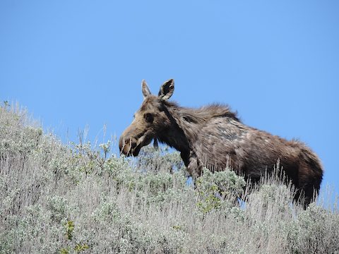
two yearling cubs) and Al's first moose since Isle Royale over 40 years ago.
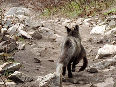
On the Jenny Lake Trail while we were
watching a marmot, a fox darted past carrying a dead marmot home to its den.
We also identified 38 species of birds.
|
At Taggart Lake, elevation 6,902 feet
|
Snow remained in patches on the west side of Jenny Lake
|
|
|
Momma Grizzly, seen from inside our truck
|
Floating down the Snake River
|
|
|
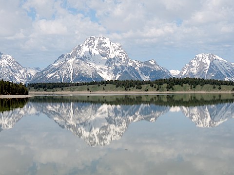
Mount Moran and its reflection in Jackson Lake
|
Our moose on the Beaver Creek Trail
|
|
|
Fox hurrying to its den with a marmot for lunch
|
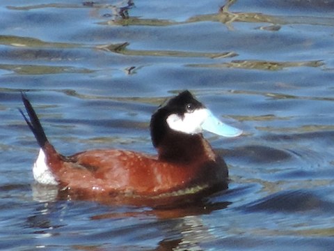
A strikingly, and comically, attired Ruddy Duck on Christian Pond
|
|
|
|
|
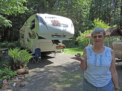
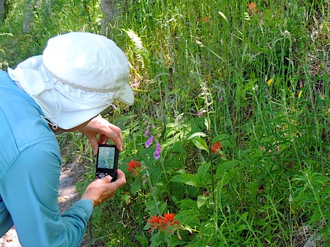
At our home for June, Gail holds Lucky Ladybug
|
|
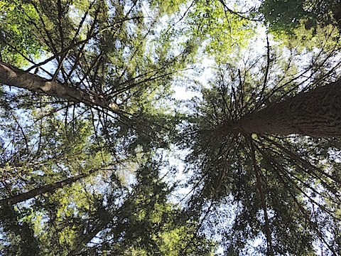
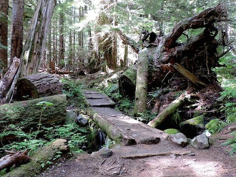
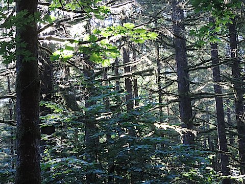
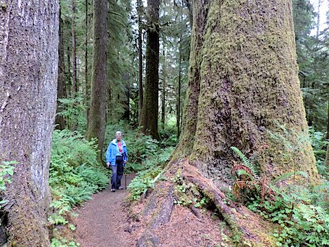
Ike Kinswa contains mature Douglas fir, bigleaf maple trees
western hemlock and black cottonwood
trees, some with trunks three
feet in diameter at the base. It also has thimbleberry bushes.
They had blossoms when
we arrived, but only two berries were ripe before we had to leave.
They were sweet!
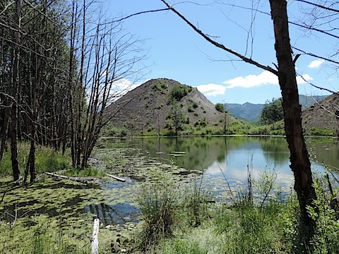
The park covers seventh-tenths of a square mile
on the north shore of Mayfield Lake, an artificial lake formed by damming the
Cowlitz River just below its confluence with the Tilton River.
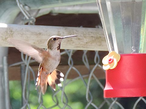
A camp host before us set up a hummingbird feeder and left us a jar full of
sugar water, a recipe for more and instructions to "Enjoy".
Well, these are voracious little creatures, feeding from 6 in the morning until 9 at night.
To keep them satisfied, we were refilling the feeder morning and night. It was
a big responsibility!
A beautiful day here starts off overcast, chilly and with a feeling of
mist in the air. It stays like that all morning, but in the early
afternoon the clouds burn off, the sky turns blue and the the day becomes warm.
During our first 10 days here, that became our expectation of how every day is.
Then a week of rainy
weather with highs in the mid 50s followed. We were excited when
better weather returned, but our experience of the first 10 days was
never duplicated.
We kept up with the news via WNPR station KSWS FM 88.9 from Chehalis.
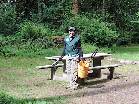
As camp hosts, we greeted campers, sold them bundles of firewood, solved minor
problems, completed odd jobs, but mostly cleaned the campsites after
campers left and before others arrived. One evening Al gave a tour of constellations
and stars in the night sky to about 20 campers.
|
|
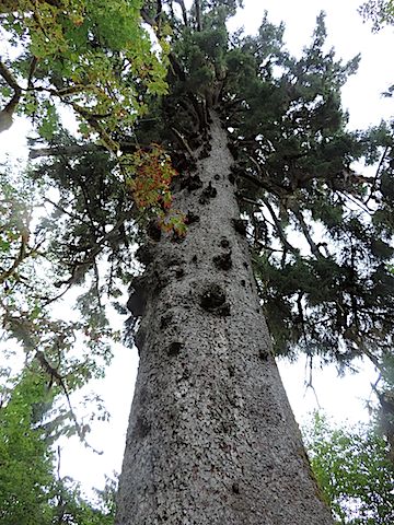
Looking up among the fir trees
|
A rufous hummingbird taking advantage of the free lunch
|
|
|
Campsite maintenance
|
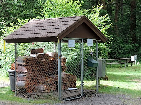
For fine firewood at $5 a bundle, see the camp hosts
|
|
|
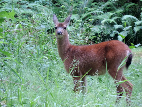
One of the many Columbian black-tailed deer, a subspecies of
the western mule deer, who entertain campers at Ike Kinswa
|
|
|
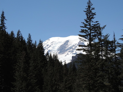
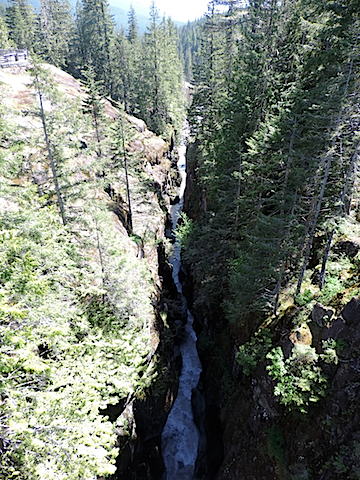
Mt. Rainier's summit seen from the Box Canyon of the Cowlitz River
|
|
|
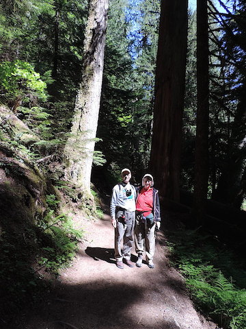
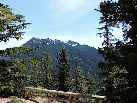
We took three one-day trips to
Mt. Rainier National Park.
On our first visit,
we went to the southeast corner in the Ohanapecosh River region.
We followed a short trail to the Grove of the Patriarchs, a small
grove of 1,000-year-old trees. Photos cannot do justice to the awesomeness
of these giants. Next we hiked to Silver Falls on the
Ohanapecosh River. Finally, we drove to the Paradise Visitor
Center. All the lakes we passed were still covered with ice, and the
visitor center still had nearly 13 feet of snow even though, at 5,400 feet, it
is much lower than where we stayed in Grand Teton.
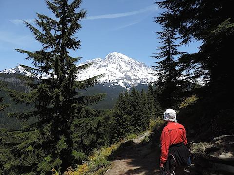
Our second visit was to the Longmire area in the southwest corner of the park.
There we climbed the Rampart Ridge Trail,
ascending about 1,300 feet in a series of
switchbacks through 1.8 miles of cathedral-like forest. After lunch
overlooking Longmire far below and Eagle Peak in the distance, we hiked another
mile along the ridge to the Wonderland Trail. We followed the Wonderland
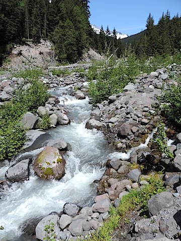
Trail to Kautz Creek, where we were disappointed to find the spring floods
had washed away the crossing, and so returned to Longmire, about 3 miles away.
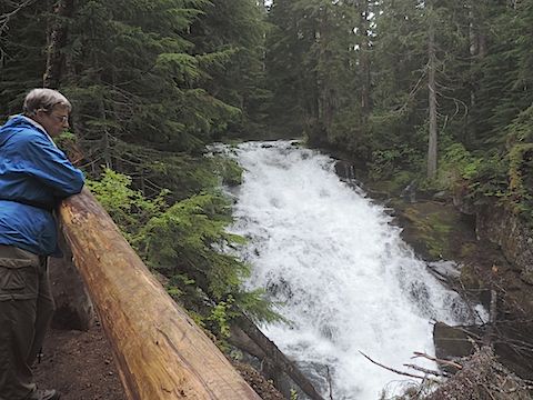
The day was cloudy with light rain during our third visit. We hiked a short
distance along another segment of the Wonderland Trail
near Cougar Rock to see Carter Falls
and Madcap Falls on the Paradise River.
|
Box Canyon of the Cowlitz, 15 feet wide, 180 feet down
|
On the trail to the Grove of the Patriarchs
|
|
|
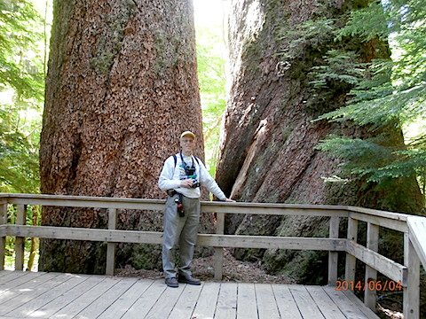
At the foot of two 1000-year-old Douglas-fir trees
in the Grove of the Patriarchs
|
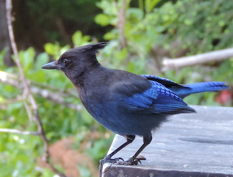
A Stellar's Jay exercising its rights
|
|
|
View from our picnic spot on the Rampart Ridge Trail
|
Mount Rainier seen from the Rampart Ridge Trail
|
|
|
Kautz Creek with a shoulder of Rainier in the distance
|
A bridge and fallen trees on the Wonderland Trail
|
|
|
Crossing the Nisqually River
|
Madcap Falls on the Paradise River
|

|
|
The view across Paradise River through low-hanging clouds
|
|
|
For our first excursion to Mt. St. Helens, we only went as far as the
Washington State Visitor Center
on Silver Lake, just a few miles off I-5.
We spent the afternoon looking at the excellent exhibits about the history and
geology of Mt. St. Helens. We even walked the 1-mile nature trail through the
wetlands alongside the lake. But we never saw the mountain because the low
clouds obscured the distant horizon.
The first time we saw the mountain was
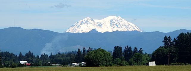
when driving to a grocery store in Winlock. We could see both
Mount St. Helens and Mount Rainier in the distance rising
above farmers' fields.
Impressive! Both mountains, and Mount Adams, tower head and shoulders
above everything else in their neighborhood so they seem to stand alone.
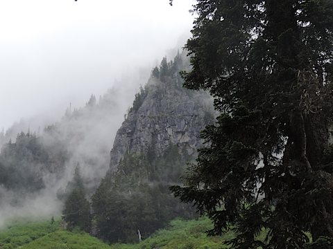
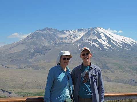
We actually visited the monument on July 2, a day that began overcast but opened up in
the afternoon. After driving through clouds, we had lunch at
Coldwater Lake and then
we hiked the Hummocks Trail, which lies on top of debris from the 1980 explosion lying
seven miles down the valley of the north branch of the Toutle River. Small hills were
formed of pulverized rock and ponds were formed where buried portions of the glaciers
melted. Now all is covered by young trees, flowers and other vegetation. Next we went
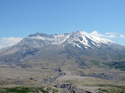
to Johnson Ridge, which has a magnificent view of the mountain and the crater left
by its explosion.
|
|
Hummock and pond along the Hummocks Trail
|
Enjoying flowers along the Hummocks Trail
|
|
|
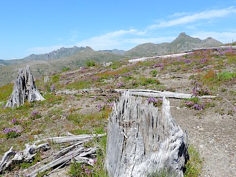
Stumps, shredded by the 1980 eruption, and flowers on Johnson Ridge
|
Mount St. Helens, its crater and the north branch of the Toutle River
|
|
|
|
Morning sun at Lewis and Clark State Park
|
|
|
Meriwether Lewis and William Clark never came anywhere near where
Lewis and Clark State Park is located when they made their cross
continent exploration, but many trees in the park were
hundreds of years old then. In more recent history, the
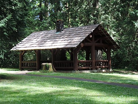
Civilian Conservation Corps had constructed some of
the facilities of the park in the 1930s.
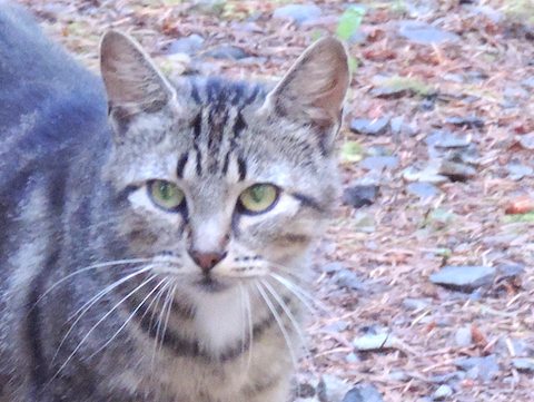
When we arrived at our campsite, we were greeted by a small, friendly
and very hungry cat,
apparently lost by an earlier camper (or strayed from a nearby farm).
A hungry, domestic predator should not be in a game preserve.
We fed her to reduce her interest in eating the park's wildlife and
tried to find a safe place
for her and the kittens she was expecting.
On Bastille Day we found her a home with Kristin, an animal
rescuer living in Portland, Oregon. Of course, we
missed the little girl afterwards.
The character of Lewis and Clark State Park was very different than
Ike Kinswa. Ike Kinswa is a "destination" park, where boaters and other
campers would come to relax for a weekend or a week. Lewis and Clark
had some campers who stayed here to enjoy the quiet and the forest,
but it also had people who just pulled off the Interstate for a
night's sleep on their way somewhere else.
In four years of camping, this was the first time that we had problems
with mice. The campsite cat did not protect us from them. We killed
three mice with a trap and stuffed steel wool into the hole under the sink
where we thought they were entering the Moving House.
That stopped them for two weeks, but then they were back and we killed four more.
|
The campsite cat
|
Was this picnic shelter constructed by the Civilian Conservation Corps?
|
|
|
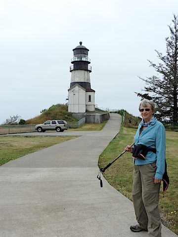
Getting all the way to the shore of the Pacific competed our voyage from
Maryland. It was far easier for us than for Lewis and Clark and their
Corps of Discovery,
but it still was over 2 1/2 hours drive each way to Cape Disappointment
from the Lewis and Clark State Park. The cape was named not by Lewis and
Clark, but by an English sea captain who, in 1788, was disappointed at not
finding the mouth of the Columbia River.
|
|
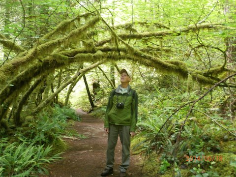
A mossy arch on the trail to Angel Falls
|
|
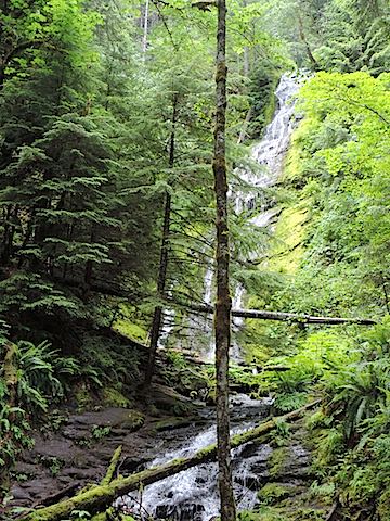
Named after the first head of the U.S. Forest Service,
Pinchot National Forest stretches from Mt. Rainier National
Park on the north, includes Mt. St. Helens and the west side
of Mt. Adams, and reaches
south nearly to the
Columbia River. We hiked a short segment
of a trail to Covel Creek to see
Angel Falls and Curtain Falls.
If we had had more time in Washington, it would have been interesting
to hike Pinchot trails at Spirit Lake and Windy Ridge on the eastern shoulder of
Mt. St. Helens.
|
|
Angel Falls of Washington, 175 feet high but only a trickle
|
On the trail to Curtain Falls
|
|
|
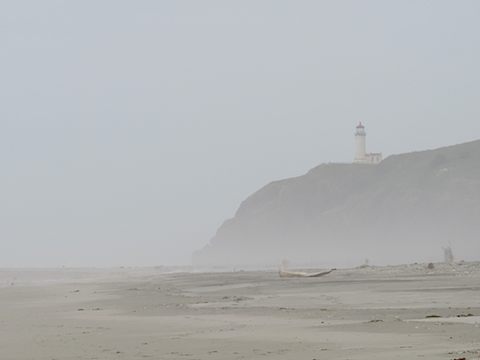
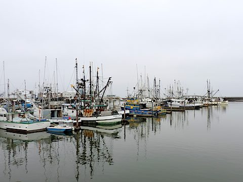
We visited the ocean again at Westport, once a prosperous
fishing village. But now the fish have been depleted and
the boats mostly sit idle. Still we hoped to find a good
seafood restaurant. Not to be. Fish and chips, or hamburger,
anyone? We did stroll on the beach, and visit the Westport
Winery with its inventive garden and the Westport microbrewery.
As at Cape Disappointment, the day was cloudy even though
there were clear blue skies 30 miles inland.
|
|
Gail in the Quinault Rain Forest
|
|
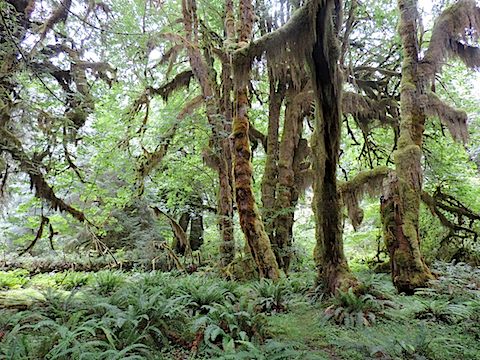
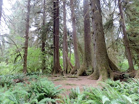
We took an overnight
trip to the Olympic Peninsula, and walked on trails in the
Quinault Rain Forest (actually in the national forest,
not the national park) and in the Hoh Rain Forest, and
on the Pacific shore again.
This may not surprise you but when we were at the rain forest,
we got rain, not much in Quinault but waves of light rain at Hoh.
It was surprising to find that both rain forests were more open than the
forests at Ike Kinswa and at Lewis and Clark.
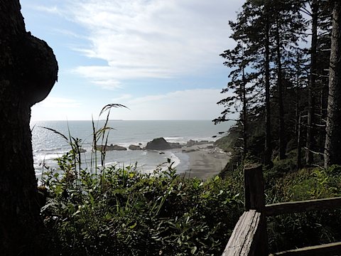
Clouds prevented us from seeing the centerpiece of the park, Mount
Olympus. However, despite the rain and clouds inland, we actually
saw sunshine when we visited the coastal segment of the park.
We did not make room reservations, thinking that it would not be hard
to get a motel room in the middle of the week.
Wrong! There are only two lodges in the park's west side and very
few other places to stay.
We wound up driving 60 miles north to the town of Forks, home of the
Twilight series, and got the last room available at the Dew Drop Inn.
|
|
World's biggest Sitka Spruce, Lake Quinault
191 feet high & 58 feet 11 inches in circumference
|
Bigleaf Maple trees with clubmoss at the
Hoh Rain Forest, Olympic National Park
|
|
|
Trees lined up on a nurse log, Hoh Rain Forest
|
Sun shining on Beach 4 in the park
|
|
|
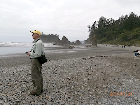
A cloudy day at Ruby Beach
|
Rock with a needle hole (Gail is looking thru it)
|
|
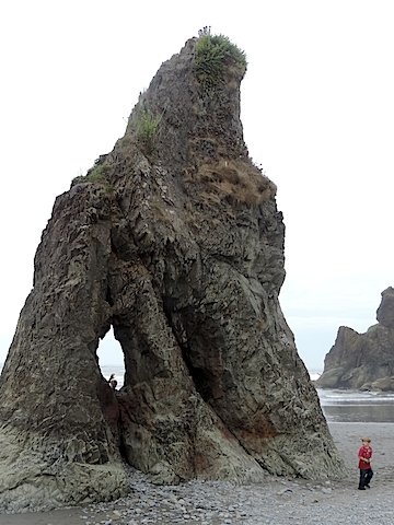
|
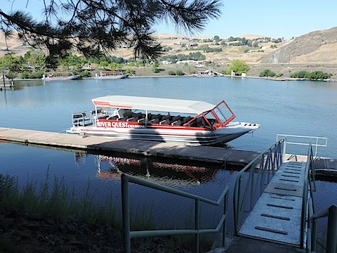
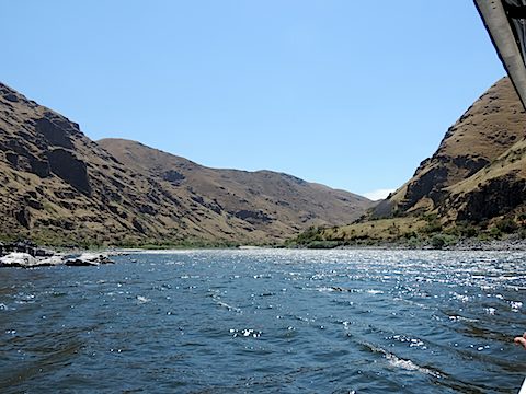
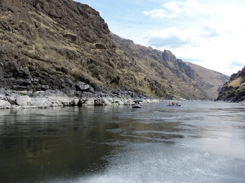
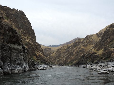
On our way home, our first adventure was a journey up Hells Canyon of the Snake River
on a jet boat. We started at the Hells Gate State Park in Lewiston, Idaho.
The sides of the canyon are not as vertical as at the Grand Canyon, but the overall
depth of Hells Canyon is greater. The name supposedly comes from the problems that
boat pilots and railroad surveyors had with this canyon at the end of the 19th century.
Nonetheless, this stretch of the river is very popular with rafters and kayakers
floating down the Snake River and the Salmon River, which joins the Snake part
way up the canyon.
We stopped for lunch at Garden Creek. After eating, Al harvested some apricots
in the orchard and sampled blackberries while Gail swam in the river. Gail was nearly
swept down river and hurt her knee so Al was the winner here.
|
|
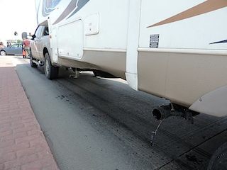
Bent panel and damaged waste water pipe
of the Moving House
|
The struck car
|
|
While exiting the Interstate at Grand Forks, our last overnight stop
before reaching Kenora,
Al hit a car with the Moving House. The driver of the car had moved it into
the intersection to make a left turn, but stopped there when the light turned
red.
Turning left onto the surface street, Al drove the truck around the car,
but the trailer tracked to the left of the truck and struck the front of the
car. Fortunately no one was injured. The Moving House still could be pulled
and was habitable, but
a side panel and the waste water system were damaged. The photos here
were taken after we moved out of the intersection.
|
|

|
Al’s grandfather, Victor, had immigrated from Sweden to Kenora, Canada, in 1909,
where his sisters Maria and Anna lived and where his brother Carl later joined them.
When Victor moved to Michigan in 1917, his siblings and their families remained in Canada.
We stopped at Kenora to visit with some of Carl's and Maria's descendants.
Our cousins reunion began with dinner at Borrelli’s Restaurant
on the Kenora waterfront. The next morning we toured the cemetery where our ancestor
Adela Olafsson and the parents and grandparents of many of the cousins are buried.
After the cemetery visit, cousin Linda took
Gail and Al on a tour of old “Swede town”
and then up Anderson Branch Road to where we now suspect that Al’s grandfather
had land along the Winnipeg River in 1913.
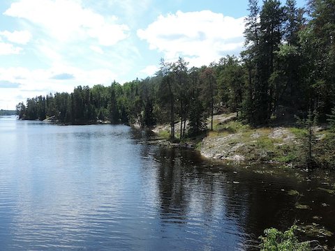
Kenora
is in a beautiful location. The main features are Lake of the Woods and the
Winnipeg River, and there are a large number of smaller lakes scattered throughout
the region.
Hills (and islands) are formed of granite outcroppings with thin deposits
of soil supporting white birch, pine, poplar and fir trees. We hiked along
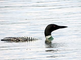
Rabbit Lake, and saw three pileated woodpeckers
and a loon. The city also has
a new microbrewery, which we visited.
|
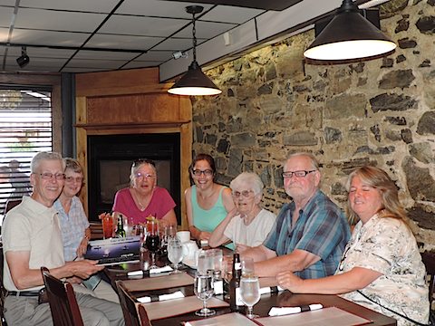
Some of the cousins at Borrelli’s
|
Rocky shoreline near where Al’s grandfather
bought 172 acres of rocky land for a farm
|
|
|
Iron County is home territory for Al and adopted home for Gail.
While the scenery is not quite as spectacular as many of the places
we visited this summer and no relatives remain there,
we find it relaxing to visit.
Within a few minutes of our setting up camp in
Bewabic
State Park,
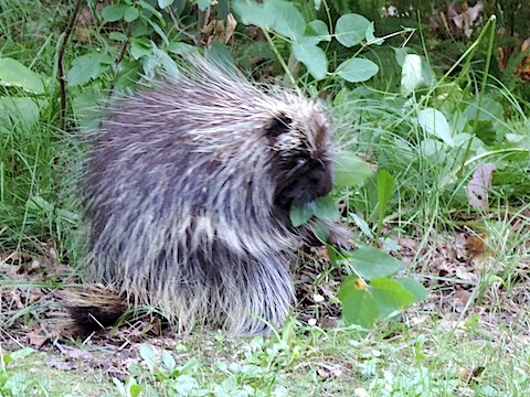
a porcupine ambled along the other side of the road, pruning the
bushes along the way. This was the first porcupine Gail had ever seen
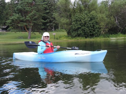
in the wild. The park has added kayak rental to its attractions
so we paddled all around Fortune Lake.
Carl rode his Harley-Davidson
down from Marquette and we had an enjoyable afternoon talking
with him.
We visited the Bernhardts - Al took a history course from Mr. Bernhardt
in high school -
and Al gave a presentation on exoplanets at the
Iron County Museum,
which the Bernhardts had founded.
Bewabic’s porcupine
|
Enjoying being on Fortune Lake
|
|
|
The reason for traveling is to see new sights and experience new activities.
This summer we encountered a couple who stowed their Smart car inside their RV as they
traveled from campground to campground. We met a woman who was traveling with four
cats in her motorhome. While driving west on I-84 in Oregon, we experienced a
72-mile stretch of uphill road with no service stations; we ran out of fuel 8 miles
east of Baker City. Al learned about cleaning fish when a family camping
at Lewis and Clark State Park gave us six trout that the
children had caught. We learned that every community in Washington, no matter how
small, must have an Expresso drive-thru. We found people who were hiding out in the parks
to avoid domestic issues. We talked to bicyclists on journeys to San Francisco, San Diego
and other distant places. We ventured all the way to the west-most end of U.S. 12.
We crisscrossed the route of Lewis and Clark's expedition,
and both of us read Stephen Ambrose's biography of Meriwether Lewis.
We had lunch at
a rest stop in Idaho with a nice family from Taiwan, who were on a lightning tour
of national parks and who were curious about what the inside of our RV looked like.
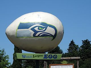
We saw what purport to be the world's largest statues of an egg, a holstein cow, and
a buffalo (bison), and
we saw what may be the largest statues of
a muskie, a black bear, and a whitetail deer.
Not bad for one summer!
|
Mt. Rainier seen from Ethel, WA, about 50 miles away
|
Near the Wind River in Wyoming
|
|
|
|
In Winlock, Washington
|
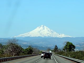
Mt. Hood from I-84 in Oregon
|
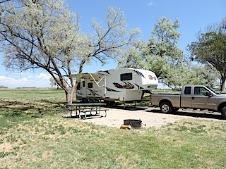
At Lewis and Clark State Park
|
|
|
|
|
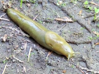
Banana slug
|
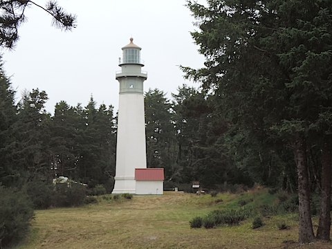
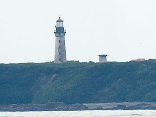
The Destruction Island Light
|
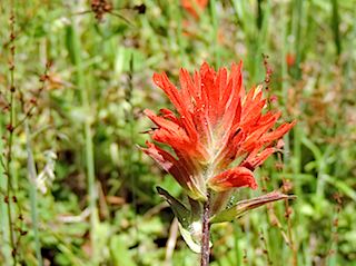
Flower near Mt. St. Helens
|
|
|
|
|
Back at Bruneau Dunes State Park
|
Loon on Rabbit Lake
|
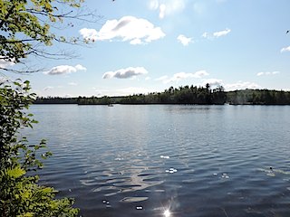
Fortune Lake
|
|
|
|
Webpage prepared by Albert Holm, 22 August 2014; updated 12 Aug 2016