2017
The Moving House does not travel light. We carried an inflatable
kayak, a small tent for side trips,
unread books and unwatched movies for entertainment,
nature guides and maps, cookbooks, lots of food, clothing that we hoped would
meet our needs in the variety of climates we might encounter, and more.
Still there were some days when it was chillier than we had
prepared for.
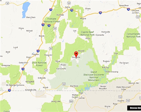
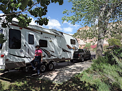
In 2017, we volunteered as camp hosts at
Escalante
Petrified Forest State Park in Utah.
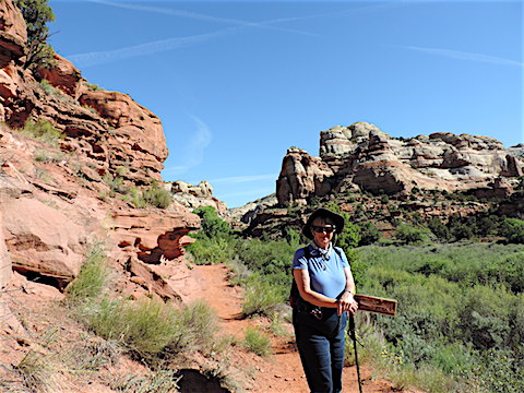
While at Escalante Petrified Forest, we had lots of recreational options.
This park is located in
southern Utah, between the national parks of
Bryce Canyon
and
Capitol Reef.
It is also on the border of the
Grand Staircase-
Escalante National Monument.
Zion National Park is within easy driving distance.
We visited each of these national parks, but spent most of our
time in the monument and in the neighboring Dixie National Forest
and state parks. Our co-workers, and new friends, at Escalante
Petrified Forest State Park provided lots of ideas for interesting
activities.
Meandering our way home, we visited
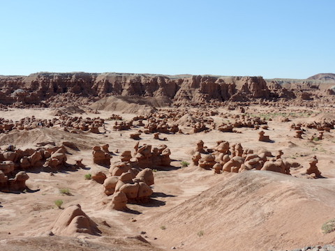
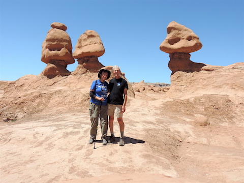
Goblin Valley State Park in Utah, the
Black Canyon of the Gunnison National Park,
a friend in Fort Collins,
the Brushy Creek Recreation Area in Iowa,
friends and relatives in the Twin Cities, Gail's classmates from
Badger High School in Lake Geneva, and Al's classmates from
Iron River High School.
|
|
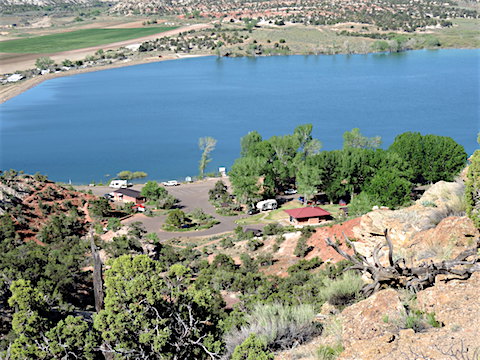
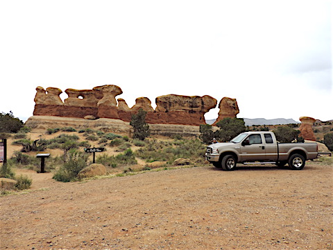
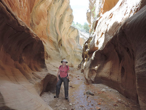
Escalante Petrified Forest State Park is located on the shores of
Wide Hollow Reservoir, an
irrigation reservoir which is stocked with fish and which has a diverse
population of waterfowl.
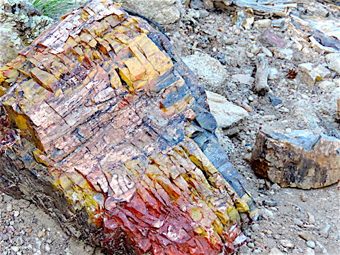
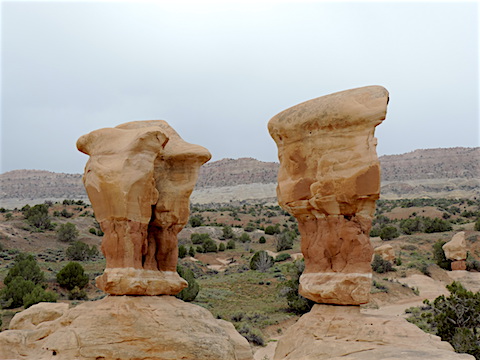
The park includes a 250-foot-high mesa with
two trails, the Petrified Forest Trail and the
Trail of Sleeping Rainbows,
having colorful examples of petrified trees.
As camp hosts, we mostly functioned as janitors for the campsites: picking up
litter, cleaning picnic tables, removing ashes, etc. Sometimes we gave
information to campers and other visitors.
Occasionally, we sold them firewood. We also worked in the
office: welcoming visitors to the park, taking their entrance fees, and
selling souvenirs.
Our campground was full nearly every night with visitors from other places
in Utah, other states, and around the world.
Visitors from Germany and the Netherlands were especially common.
Most of the foreign visitors rented a Class-C RV in the USA for their
travels, but one Swiss couple converted a Swiss ambulance into an
RV and shipped it to America for their adventure.
|
The new campground hosts on duty
|
A view of the park entrance and reservoir from the mesa
|
|
|
One of the colorful logs along the Trail of Sleeping Rainbows
|
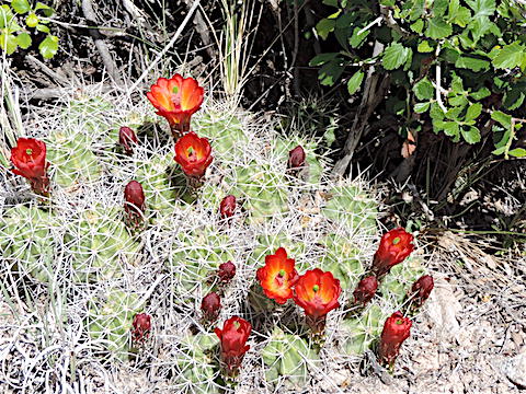
Claretcup cactus with blossoms on the Petrified Forest Trail
|
|
|
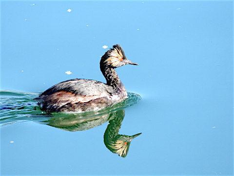
An Eared Grebe on the reservoir
|
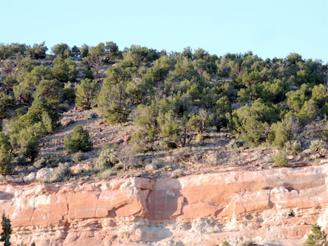
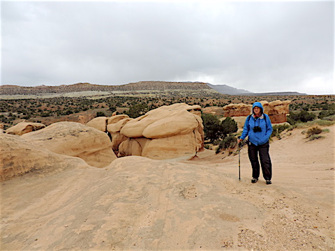
A pygmy forest of pinyon pine and Utah juniper above the campground
|
|
|
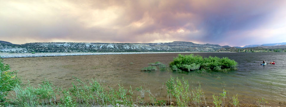
Smoke from the Brian Head wild fire, 70 miles west of us, darkens the sky and water
at the Wide Hollow Reservoir
|
|
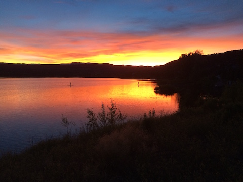
Sunset with smoke from the Brian Head fire
with two paddle boarders on the reservoir
|
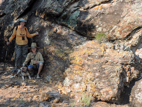
Gail and our co-worker Jen with a huge Petrified Log on the
seldom visited east side of Escalante Petrified Forest State Park
|
|
|
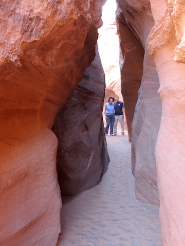
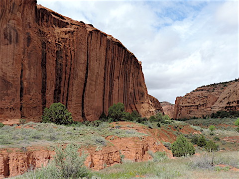
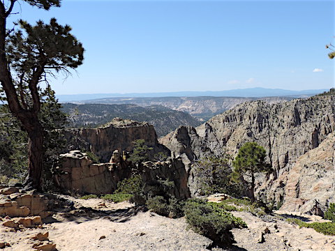
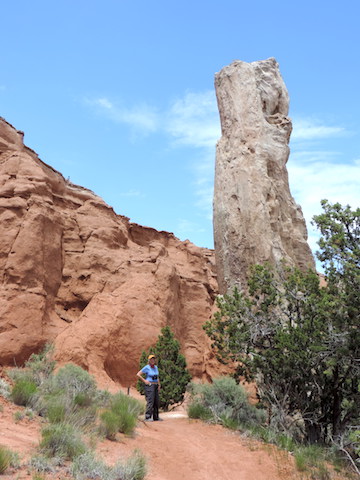
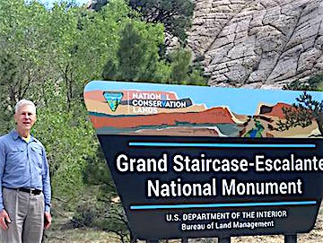
Grand Staircase-Escalante National Monument and More
The Grand
Staircase-Escalante National Monument surrounds the town
of Escalante so we had plenty of opportunities to visit it.
Nestled next to the monument are the Dixie National Forest,
the Box-Death Hollow Wilderness Area and
two Utah state parks - Anasazi State Park and Kodachrome Basin
State Park.
We also visited them. In fact, we had originally come to this
region to see the national parks, but the crowds in them turned us
off and most of our adventures were in the National Monument and
surrounding areas.
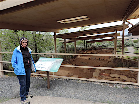
The excavated ruins of an Ancestral Pueblo
dwelling at Anasazi State Park
|
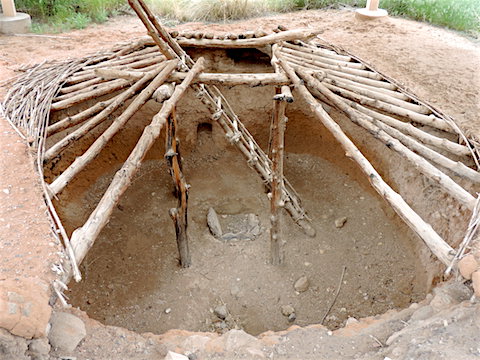
Excavated and partially reconstructed pithouse
at Anasazi State Park
|
|
|
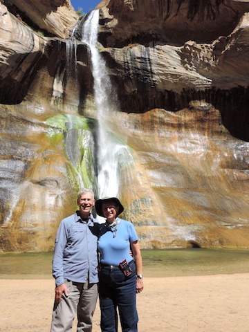
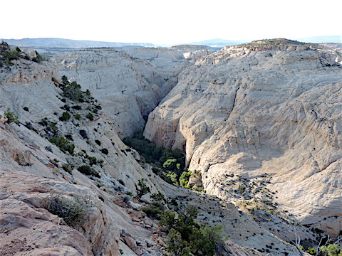
After a 3-mile hike to the 126-foot high
Lower Calf Creek Falls
|
Pictographs on the wall of Calf Creek Canyon
made by Native Americans of the Fremont culture
|
|
|
Calf Creek Canyon has beaver dams as well as well as pictographs,
ruins of ancient granaries, and waterfalls
|
Desert varnish on canyon walls along the Burr Trail Road.
Black color is manganese-rich varnish produced by microbes
|
|
|
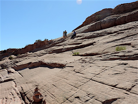
Hole-In-The-Rock Road goes through the monument southeast
from Escalante to the Colorado River. Hole-In-The-Rock is where
Mormon pioneers used blasting powder and picks to widen a
crack in the Colorado’s canyon wall to allow wagons and families
to be lowered 900 feet to cross the river.
The road is washboard and people are warned not to try to
drive it after a rain storm.
It takes you past a number of locations for hiking and adventure.
When you are in Escalante, check out the
Hole-In-The-Rock Heritage Center
on the east end of town. It is a nice little museum that tells the
story of the pioneers.
A western traffic jam on Hole-In-The-Rock Road
|
Formations at Devil’s Garden
|
|
|
Devil’s Garden scenery
|
Gail at Devil’s Garden
|
|
|
|
|
|
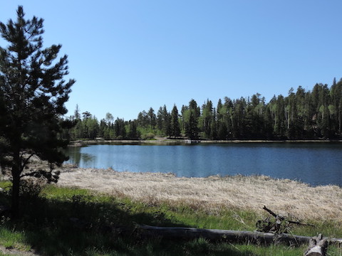
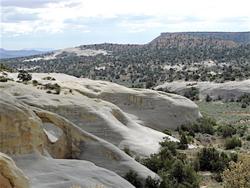
Posey Lake, in the mountains north of Escalante and 2,800 feet higher, was
much greener and cooler
|
|
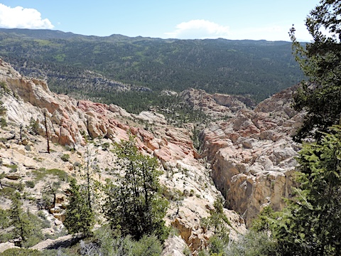
Hells Backbone Road, constructed by the CCC and winding through
the mountains north of Escalante, was washboard all the way, as
were most of the best roads in Dixie National Forest and in
Grand Staircase-Escalante National Monument. The road took us to the
Hells Backbone Bridge and a grand view of the Box-Death Hollow
Wilderness.
A sign by the bridge tells us how it was originally built in 1933.
“With typical Yankee ingenuity”, the CCC felled two tall,
straight pine trees, leveled them off topside, placed them across the gap,
and secured them in place.
Then a man secured a safety rope around his mid-section
and slowly inched a bulldozer onto the logs and across the chasm.
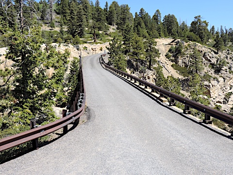
The modern Hells Backbone bridge, built in 2005
|
Looking east from the bridge
|
|
|
Looking west from the bridge to the Box-Death Hollow Wilderness
|
Death Hollow Canyon, at sunset, where it joins the Escalante River Canyon
|
|
|
The region of the Monument a little southeast of Bryce Canyon is home
to lots of sights. We visited Kodachrome Basin State Park and Grosvenor Arch,
and hiked the Willis Creek trail.
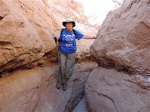
The sculpted walls of Willis Creek’s slot canyon
|
Gail by Willis Creek
|
|
|
|
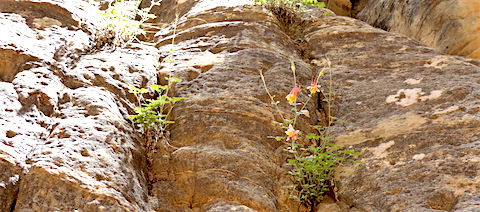
Flowers grow wherever water is available along the
canyon wall. By the time Willis Creek reached
Sheep Creek, just two miles from the trail head,
we saw that all its water had disappeared, soaked into the ground.
But during flash floods, this canyon likely is
torrent and the flowers need strong roots in the
cracks in the rocks to avoid being washed away.
|
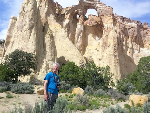
Grosvenor Arch is actually a double arch
|
Kodachrome Basin State Park features spires
of hard, grey stone
that penetrated the softer red sandstone
|
|
|
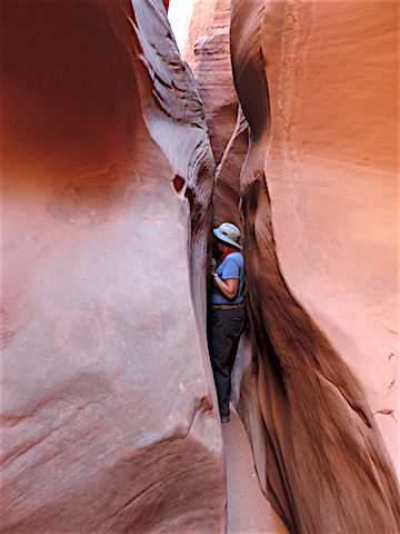
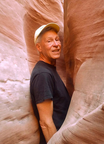
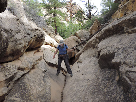
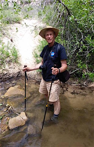
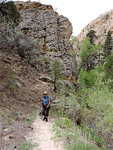
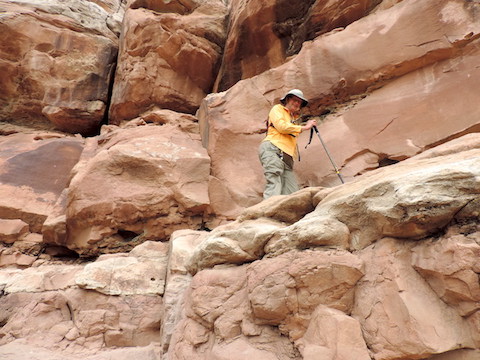
The Box Trail follows
Pine Creek in the Box-Death Hollow Wilderness.
It requires multiple crossings of the fast-flowing, cold Pine Creek.
We went wrong at the very beginning, following a fake trail into the rocks,
but found our way down again and enjoyed the creek-side trail.
It is easier to go up the wrong trail than to come down
|
Fording the cold creek felt good on my twisted ankle
|
|
|
Most of the trail was on land
|
|
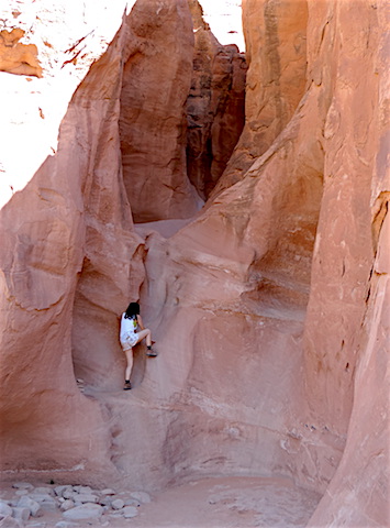
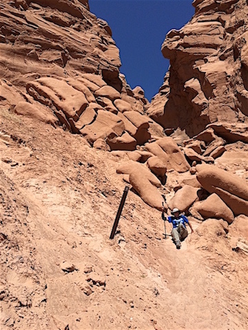
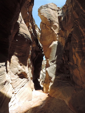
Many visitors to our park spoke of having visited the
Peak-A-Boo
and Spooky slot canyons
or of wanting to visit them, so we did too.
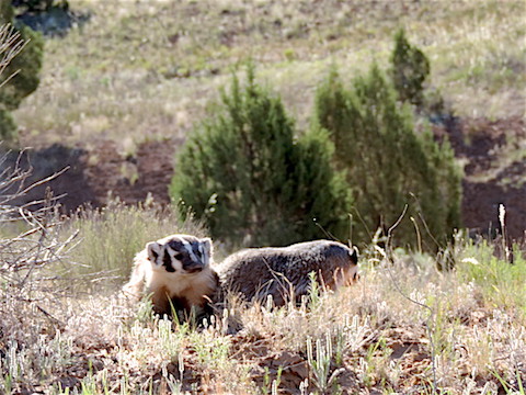
They are 26-miles down Hole-In-The-Rock Road and on our way we
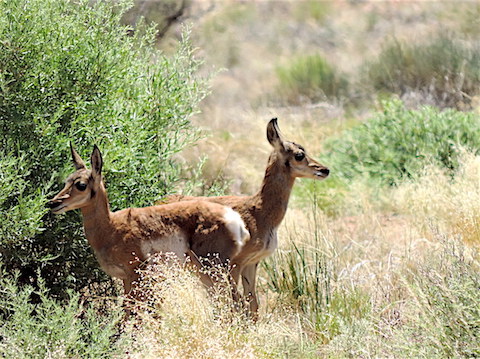
saw two badgers on the roadside.
The side road leading to the trail head is quite challenging, drivable
only with high-clearance vehicles and featuring a large boulder
before the parking lot at the end of the road.
After parking, the visitor must first descend 300 feet into
Dry Fork Coyote Gulch and the adventure begins there.
The badgers, new mammals for our “life list”
|
The do-it-yourself slick rock trail into Dry Fork Coyote Gulch
|
|
|
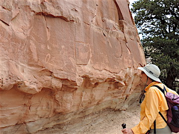
The 100 Hands Trail was not marked on any of the maps we got from the
Interagency Visitor Center in Escalante and there are no trail markers
until after you already are on the trail. Jen told us about it.
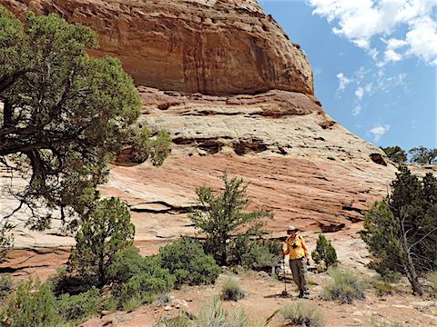
Near the start of the 100 Hands Trail
|
The first petroglyphs on the trail were damaged by looters
|
|
|
Not all of the trail borders vertical drops
|
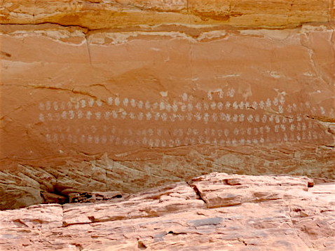
The 100 Hands Petrograph, for which the trail was named
|
|
|
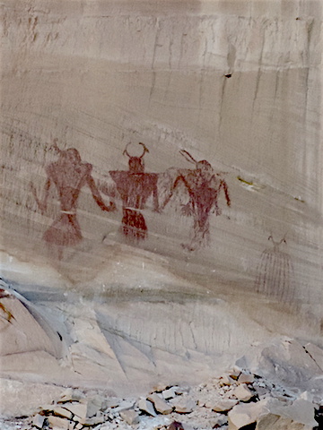
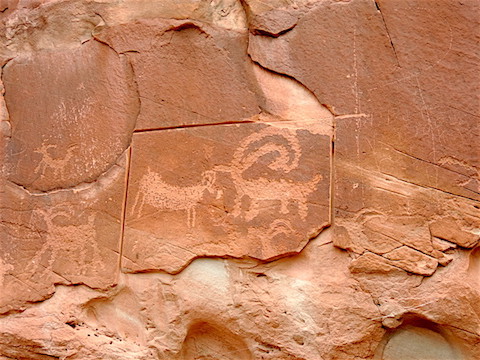
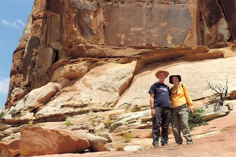
Soon you reach the Shaman petroglyphs
|
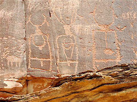
Details of the central figures in the Shaman petroglyph panel
|
|
|
|
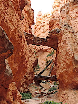
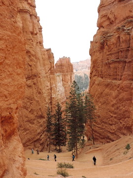
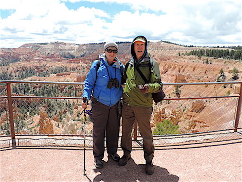
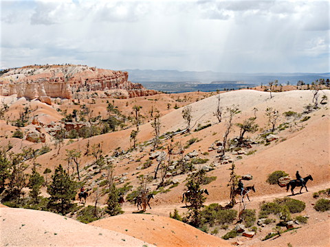
BRYCE CANYON NATIONAL PARK
Bryce Canyon National Park
is about 50 miles west of Escalante
along Utah Route 12. The park is 2,000 to 3,000 feet higher
than Escalante, and the weather is proportionally cooler.
We made a day trip to the park on May 18. On the previous day,
the park had had snow and the weather was just about freezing, so we
were surprised to find the parking lots within the park filled
with cars. This was the middle of May! What were all these
people doing here?
There is a shuttle bus system that carries visitors between the
most popular sites in the northernmost three miles of the park.
We parked at the shuttle lot outside the park and rode the bus
around. By the afternoon the buses had standing room only.
Welcome to a popular park!
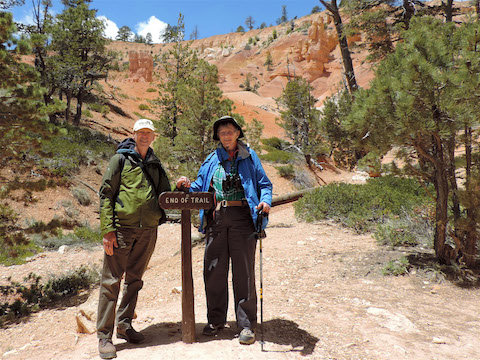
We braved the crowds once more, on June 7, to see the
bristlecone pines at the south end of the park.
|
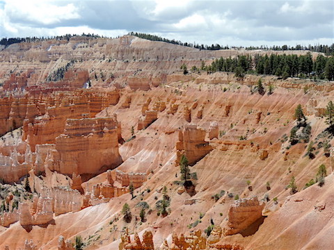
Bryce Canyon scenery from the rim
|
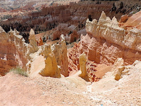
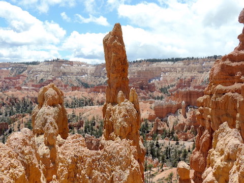
Hoodoos - pinnacles - below the Queen’s Garden Trail
|
|
|
More Bryce Canyon hoodoos
|
A John Wayne western? No, tourists taking the “easy” way.
|
|
|
|
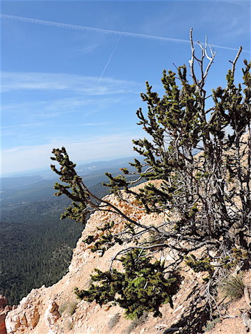
A gnarled bristlecone pine tree at the edge of the abyss
|
Lower down in the canyon and later in the day
Yes, the trail ended there, but we still had to hike back up!
|
|
|
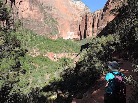
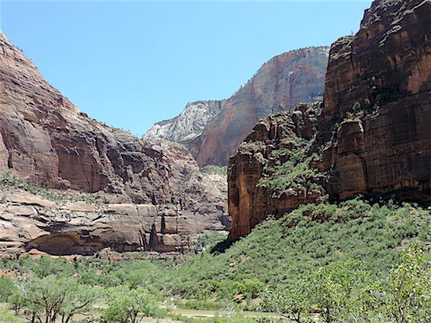
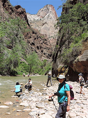
ZION NATIONAL PARK
Zion
National Park is different from the other canyon-based parks
we've been to. At the other parks - Grand Canyon, Bryce Canyon,
Dead Horse Point, Canyonlands: Island in the Sky, Black Canyon
of the Gunnison - the typical
visitor, such as us, arrives on the rim of the canyon and looks
down into the void. At Zion, you come up the the river valley
in the bottom of the canyon. The valley floor is lined with
massive towers, some with flat tops, some cone-shaped, many so tall
and close to the river that they are seen through the vents
on the top of the shuttle buses
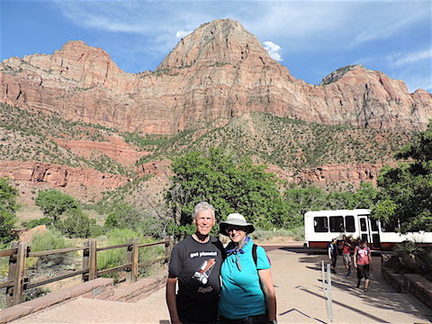
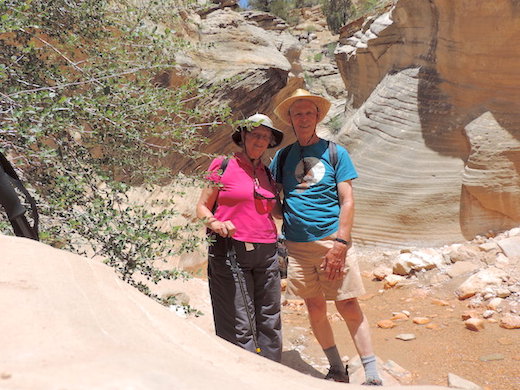
We made a side trip to Zion
from May 23 to 25, taking our camping tent and leaving
our Moving House at the state park. The journey
took an hour longer than expected due to road work and
one-lane traffic through the Zion-Mount Carmel Tunnel,
but we got there. It was clear to us that Zion was even
more crowded than Bryce Canyon had been the week before.
Trailer buses, full of people even early in the morning,
shuttled people between eight stops in the park.
Welcome to the world of the mega-park!
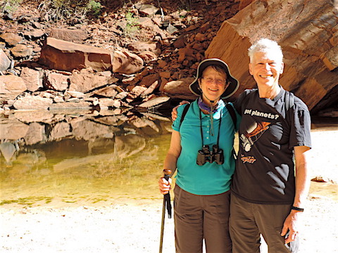
We had a good morning, starting early, eating
our breakfast in the park, and hiking the moderately
rugged trails to the Emerald Pools and back
before the crowds arrived.
After lunch, we took the paved Riverside Trail
to the northern-most point you can reach without wading
in the Virgin River.
Having easily done the more rugged trail in the morning,
I tripped on the flat, paved one and twisted my ankle.
I was able to finish the walk and return to the trail head,
but it put a damper on further hiking during our visit
and on hiking during the next couple weeks.
|
|
|
|
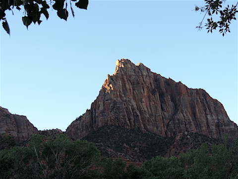
Early light strikes Watchman Peak, near the south end of
Zion National Park.
|
On the Kayenta Trail to the three Emerald Pools
|
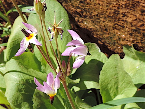
Palmer’s Penstemon blossoms on the Kayenta Trail
|
|
|
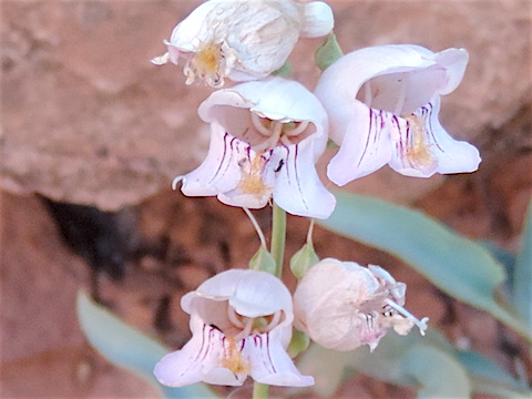
Zion Shooting Stars growing against a moist cliff
|
At the Upper Emerald Pool
|
|
|
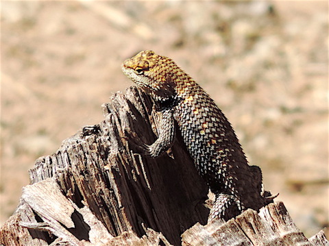
A Desert Spiny Lizard on a stump near the Virgin River
|
Typical scenery in the upper canyon, near the Big Bend
|
|
|
Towers upon towers near the Temple of Sinawava
|
Golden Columbine clinging to a cliff side
|
|
|
With the afternoon crowds at the end of the Riverside Trail
|
At 7 PM, nearing the end of our day at Zion
|
|
|
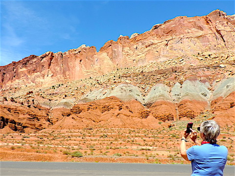
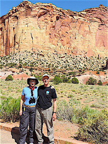
CAPITOL REEF NATIONAL PARK
Capitol Reef National Park
features richly colored rocks, grand geological formations,
challenging hiking trails,
but also orchards planted along the Carson River by the early Mormon
settlers. The people at the Visitor Center told us we could buy a pound
of freshly picked cherries at the campground store, but they were sold out
by the time we got there. Oh, well. We spent little time in this park
because it is a couple hour drive from Escalante and because we'd
already spent the morning navigating the Hell’s Backbone Road.
One of the richly colored cliffs in Capitol Reef
|
At the end of Scenic Drive, near the Ephram Hanks Tower
|
|
|
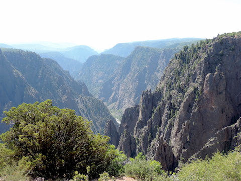
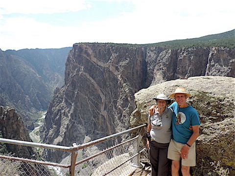
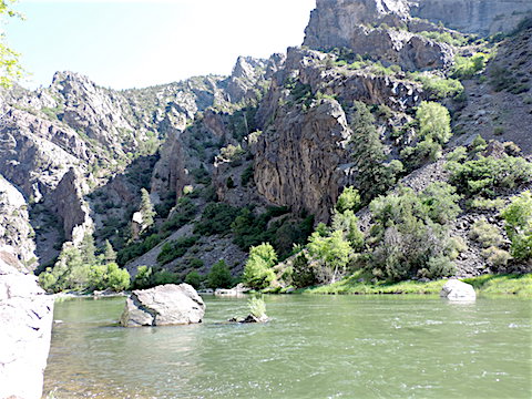
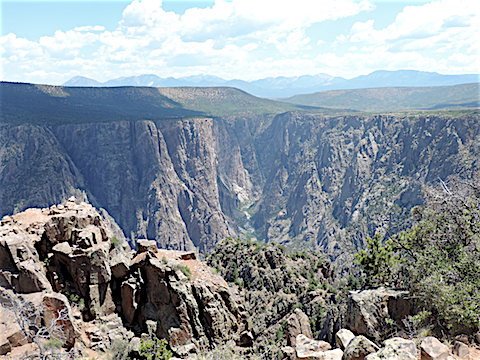
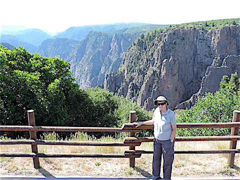
BLACK CANYON OF THE GUNNISON NATIONAL PARK
16 percent down grade! Lots of switchbacks! That's the route from the canyon rim
to the river at East Portal. Gail drove it on the second of our three days
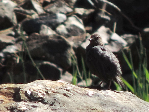
at the park. Down by the river I got a photo of an American Dipper bird,
a diving bird smaller
than a Robin, that I had been stalking for three years. Thanks, Gail!
The
Black Canyon of the Gunnison
National Park is located in western Colorado and does not attract the
hordes of visitors who visit the parks in Utah. We hiked along the rim
and visited view points in addition to our journey to the bottom.
It made us nervous when other visitors would climb on top of or
around walls constructed to protect people from falling. It's a
long way down.
MEANDERING OUR WAY HOME
After the Black Canyon of the Gunnison, we visited a friend in
Fort Collins, CO, hiked in a recreation area in Iowa,
visited friends and relatives at the Twin Cities,
and had reunions with classmates in Lake Geneva, WI, and
Iron River, MI.
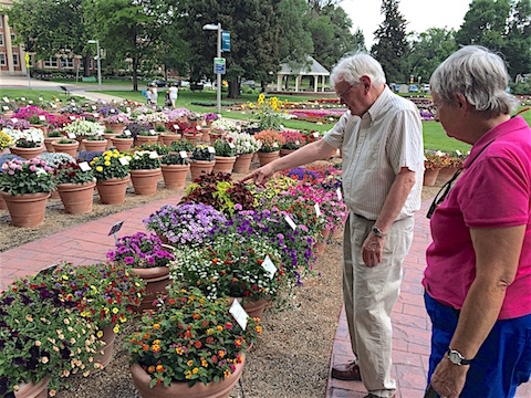
Eddie and Gail marveling at the exotic flower colors
at the Flower Trial Garden at Colorado State University
|
No bridge over Brushy Creek in Iowa?
Not a problem after our experience fording streams in Utah
|
|
|
With my sister, Terri, and some of my third cousins
in the Turnblad Mansion of the American Swedish Institute in Minneapolis
|
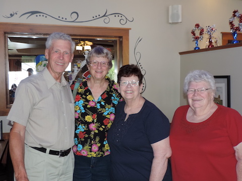
With Gail’s classmate Carolyn, and her sister, Janice,
after a school reunion luncheon in Lake Geneva, WI
|

|
|
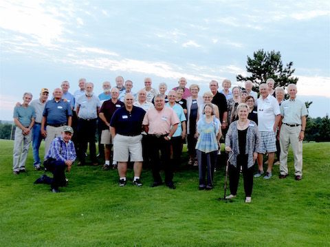
Some members of the Iron River High School class of 1962
55 years later
|
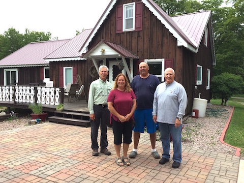
At the house my grandfather built more than 70 years ago,
with my brother, Carl, and the current owners, Steve and Lori
|
|
|
|
On the road for 90 days, we
pulled the Moving House 5,697 miles and drove the truck an additional
2,366 miles. We travelled through thirteen states,
and visited four National Parks. We visited with family,
former classmates, and newly-found cousins. We visited with
old friends and made new ones.
We had a good time!
The only significant problem we had traveling was when
a tire blew out on Colorado highway 14.
We quickly recovered
from that and were on our way again, thanks to a polite young man
with lots of tattoos and an NRA patch on his shirt.
After living in Escalante for two months with its tiny four-aisle
Griffin's Grocery Store, it was a shock to return to the “big”
cities
and their massive supermarkets where the amount of goods and food
nearly was overwhelming.
We survived very well with the limited
shopping options in Escalante, getting our food from Griffin's, our
dark chocolate from the Escalante Mercantile Organic grocery, and our
beer from the state liquor store housed in a closet of Escalante
Outfitters. However, it felt good to be able to get haircuts when we got to
Montrose, Colorado. The only barber shop in Escalante had gone out
of business and the woman we were told gave haircuts had moved out of town.
|
|
Here are a few more scenes from our summer.
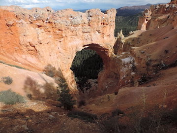
Bryce Canyon’s Natural Bridge, elevation 8627 feet,
32ºF and snow flurries on May 18
|
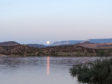
Moonset over Wide Hollow Reservoir
at Escalante Petrified Forest State Park
|
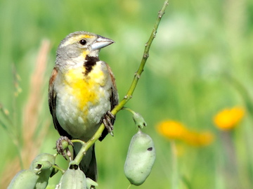
A Dickcissel at Iowa's Brushy Creek
State Recreation Area
|
|
|
|
Grand Staircase-Escalante National Monument
|
Inspecting some petroglyphs on the 100 Hands Trail
|
Cedar Draw Arch in Grand Staircase-Escalante
|
|
|
|
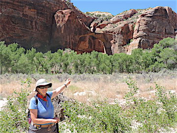
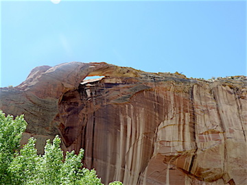
The Natural Bridge in the Escalante River Canyon
|
The Natural Arch in the Escalante River Canyon
|
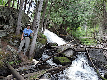
Chicagon Falls in Iron County, Michigan
|
|
|
|
Stained glass window in the Turnblad Mansion
|
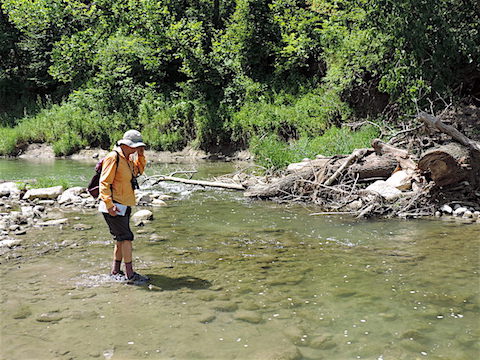
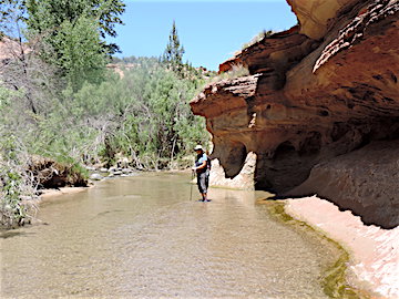
Refining our fording skills at the Escalante River
|
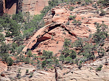
Crawford Arch at Zion National Park
|

|
|
|
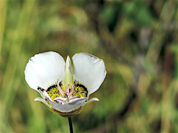
Gunnison's Mariposa Lily
|
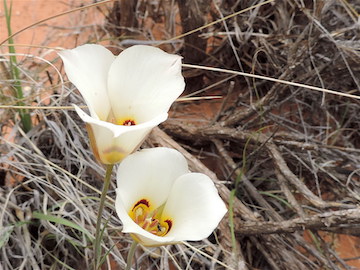
Sego Lilies at Kodachrome Basin State Park
|
Pasties, comfort food in Michigan’s Upper Peninsula
|
|
|

|
Al Holm, 3 August 2017; updated 13 September 2017 & 13 October 2025